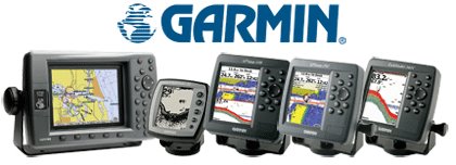
Garmin’s new line of chartplotters and fishfinders
“Garmin’s new line of chartplotters and fishfinders literally puts the world at boaters’ fingertips,” said Gary Kelley, Garmin’s vice president of marketing. “With Garmin’s newly-enhanced marine cartography, mariners can spend less time deciphering charts and more time enjoying their time on the water. These new units offer a wide variety of display sizes and networking options that will attract everyone from the weekend angler to the dedicated offshore mariner.”
The GPSMAP® 492 features built-in Marine Detail Charts of the United States coastline, including Alaska and Hawaii – utilizing elements of Garmin’s new BlueChart® g2™ technology. These charts provide integrated maps for a much smoother presentation. BlueChart g2 has all the detail of traditional BlueChart, but with 3D perspective, and richer detail and content – data like tides and currents overlaid on the chart. Other chart features include shaded depth contours, port plans, wrecks, restricted areas, and more.
For boaters who spend their time on inland lakes, the GPSMAP 392 boasts 50-meter shoreline resolution for lakes across the entire continental United States. In addition, highly-detailed 10-meter resolution is furnished for more than 2000 of these lakes. The vast majority of these high resolution lakes include depth soundings. In addition, the maps depict USCG lights; a wrecks and obstructions database; tides overlaid on the map; interstates, state highways, and rural roads; and a unique selectable three-dimensional display. Inland lake maps are also provided via regional data cards, so boaters have the option of loading Garmin’s other new chartplotters with these maps.
The GPSMAP 292 features an enhanced World Wide Basemap with a 300-meter shoreline resolution, and features major interstates and highways, and real-time information on tides and currents for the United States.
All units can be supplemented with BlueChart g2 data cards as well, which offer the same features as pre-loaded charts – plus highly-detailed coastal roads and points of interest such as restaurants, lodging, local attractions, and more. Full-color aerial photos of ports, marinas, bridges, and navigational landmarks are also initially available for the east coast of the United States from Georgia through Maine, selected lakes in the Great Lakes region, and partial coverage of the west coast. The estimated retail price for U.S. data cards starts at $199 – far less than competitors’ data cards.
For those who want a space-saving chartplotter and sonar combination unit, Garmin also offers the GPSMAP 298, GPSMAP 398, and GPSMAP 498. These units include either dual frequency or dual beam sonar capability, in addition to the chartplotting abilities of the GPSMAP 292, 392, and 492.
In addition, Garmin has added pre-loaded charts to its family of larger-display chartplotters. The new GPSMAP 3205, GPSMAP 3206, and GPSMAP 3210 all feature pre-loaded Marine Detail Charts of the United States coastline, including Alaska and Hawaii. Like Garmin’s other new chartplotters, this cartography features a new 3D perspective and data like tides and currents. These models have all of the same networking capabilities of other multifunction displays within the Garmin Marine Network™, a system that combines GPS, radar, XM WX Satellite Weather, sonar, and other data for unparalleled situational awareness.
For boaters who want value-priced, large-display color chartplotters with limited networking capability, Garmin is offering the GPSMAP 2206 and GPSMAP 2210. Like the other new chartplotters, these units offer pre-loaded charts that utilize elements of Garmin’s new BlueChart® g2™ technology. For boaters wanting the capacity to load g2 technology onto their units via data card, Garmin will also offer the GPSMAP 2106 and GPSMAP 2110.
A number of new features come standard on all new Garmin fishfinders. To help freshwater anglers better pinpoint fish, Garmin now offers Ultrascroll™, which allows boaters to get a much faster refresh rate on their sonar display. The new line of units also have improved performance in shallow water – as little as a foot deep – that makes it easier to determine depth, structure, and fish targets. Auto gain, as well as user adjustable gain, is also standard on all of Garmin’s new fishfinders.
For serious anglers, Garmin offers the Fishfinder 340C – a full-featured sonar that offers a sunlight readable five-inch (diagonal) 320 x 234 pixel full-color TFT display. The Fishfinder 340C is offered in either a dual frequency configuration (50kHz, 45 deg and 200 kHz, 10 deg) – or, for inland anglers needing a wider fish-finding cone, a dual beam model (80kHz, 45 deg and 200kHz, 14 deg). Water temperature, a round flasher-style display, and an A-scope display also come standard on the Fishfinder 340.
In addition, the 340C is also enabled with Garmin’s new CANet™ -- a one-megabit Controller Area Network that allows users to connect their unit to one of the new GPSMAP® 200, 300, or 400-series chartplotter. This allows boaters to read sonar displays on chartplotters located elsewhere in the boat.
The new Fishfinder 160C offers anglers both utility and affordability. The unit is primarily targeted at inland boaters, with the same dual beam transducer as the Fishfinder 340C. The unit features a sunlight readable 4.5” (diagonal) 128 x 128 pixel, 16-color CSTN display.
For the value-minded boater, the new Fishfinder 140 features a 4.7-inch (diagonal) four-level grayscale FSTN display and a dual beam transducer (80kHz, 45 deg and 200kHz, 14 deg). For entry-level consumers, Garmin recommends the Fishfinder 90, with a four-inch (diagonal) 128 x 64 pixel black-and-white FSTN display.
posted by Butler Outdoors @ 3:32 PM
0 comments
![]()
